Driving
Lake Isabella to Bakersfield
Updated: 28 May 2026
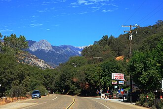
The journey from Lake Isabella to Bakersfield covers approximately 75 kilometers through the scenic Kern River Canyon. You will primarily use California State Route 178, which winds alongside the Kern River. The drive typically takes about 60 to 75 minutes depending on traffic near the canyon entrance. This route is the primary artery for residents commuting to the Central Valley. Expect steep grades and winding turns as you descend from the mountains into the valley floor.
Total Distance: 75 km driving distance; 65 km straight-line air distance.
Fastest Way
Driving via CA-178 is the fastest route, taking just over an hour.
Cheapest Way
Driving your own vehicle is the most cost-effective method for this short commute.
Compare Lake Isabella to Bakersfield Routes
Driving
Direct
Duration
1 hour 10 mins
Avg Price
$10-$15 in fuel
Operator
Personal Vehicle
Route
CA-178 West through Kern River Canyon.
Watch for rockfall warnings during heavy rain seasons.
Travel Tips
-
Check Road ConditionsAlways check Caltrans for CA-178 closures due to maintenance or weather.
-
Fuel UpFill your tank in Lake Isabella as gas prices can be higher in remote mountain areas.
-
Drive During DaylightThe canyon road lacks significant lighting, making daylight driving safer and more scenic.
-
Watch for WildlifeDeer and other wildlife frequently cross the road in the canyon section.
-
Traffic PatternsAvoid commuting during peak morning and evening hours to bypass Bakersfield city traffic.
Safety Tips
-
Speed LimitsAdhere strictly to posted speed limits, especially on the sharp curves of the canyon.
-
Brake UsageUse lower gears on the descent to prevent brake overheating.
-
Emergency KitKeep a basic emergency kit in your car, including water and a flashlight.
-
Cell ServiceExpect intermittent cell service in the deeper parts of the Kern River Canyon.
People Also Ask
-
Is CA-178 safe to drive?Yes, it is a well-maintained highway, but requires caution on curves.
-
Are there buses to Bakersfield?Kern Transit provides limited service between the mountain communities and Bakersfield.
-
How long is the drive?The drive typically takes between 60 and 80 minutes.
-
Is there snow in the canyon?Snow is rare but possible at higher elevations during winter storms.
-
What is the best time to leave?Mid-morning or mid-afternoon avoids the heaviest commuter traffic.
Quick Info
- From Lake Isabella, California, United States
- To Bakersfield, California, United States
-
Modes
Best Time to Travel
Spring and Autumn offer the best visibility and mild temperatures for the canyon drive.
Things to Do in Bakersfield
1
Kern River Canyon
Enjoy the dramatic rock formations and river views along the drive. Pull over at designated turnouts for photography.
2
Bakersfield Museum of Art
Located in downtown Bakersfield, this museum features regional art and rotating exhibits. It is a cultural hub for the city.
3
Buck Owens Crystal Palace
Experience live country music and a museum dedicated to the Bakersfield Sound. It is a landmark venue for music lovers.
4
Hart Memorial Park
A large park along the Kern River offering picnic areas and walking trails. It is perfect for a relaxing afternoon.
Tags
Lake Isabella to Bakersfield drive
CA-178 route
Bakersfield transport
Kern River Canyon drive
Lake Isabella travel guide
Kern County transit
driving to Bakersfield
Lake Isabella commute