Flight
Driving
Richland to Bakersfield
Updated: 31 May 2026
The journey from Richland to Bakersfield covers approximately 1,500 kilometers. Driving is a popular option, typically following I-84 and I-5 through the scenic landscapes of the Pacific Northwest and California. Flying is also available, usually involving a connection in a hub like Seattle or San Francisco. You will experience a transition from the high desert of Washington to the agricultural heartland of California. Bakersfield is a major hub for energy and agriculture, making this a popular route.
Total Distance: Driving distance 1,550 km, air distance 1,300 km.
Fastest Way
Flight via PSC to BFL is the fastest, taking roughly 7 hours.
Cheapest Way
Driving is cost-effective for groups, while flights are better for solo travelers.
Compare Richland to Bakersfield Routes
|
Connecting
|
Direct
|
|
|---|---|---|
| Duration | 7 hours | 16 hours |
| Avg Price | $400 - $700 | $300 - $450 in fuel |
| Operator | United / American Airlines | Personal Vehicle |
| Route | PSC to SEA/SFO to BFL | I-84 E to I-5 S |
| Tip | Meadows Field Airport (BFL) is the primary airport. | Plan for two days of driving to ensure safety. |
Travel Tips
-
BookingBook flights at least three weeks in advance for better pricing.
-
PackingPack light, breathable clothing for the hot Central Valley climate.
-
NavigationUse a GPS app for navigating the city's grid system.
-
Airport TransportUse rideshare services from BFL to reach the city center.
-
Local EventsCheck the city calendar for festivals that impact travel.
Safety Tips
-
Road SafetyBe cautious of heavy truck traffic on I-5.
-
Weather AlertsMonitor weather reports for potential heat waves.
-
Vehicle SecurityKeep valuables out of sight when parked in public areas.
-
HydrationStay hydrated during long drives, especially in the summer heat.
People Also Ask
-
Is there a direct flight?No, all flights from Richland require at least one connection.
-
How long is the flight?Total travel time including layovers is typically 6 to 10 hours.
-
What is the best route?I-84 to I-5 is the most common route for driving.
-
Are there trains?No direct rail service exists between Richland and Bakersfield.
-
What is the time difference?There is no time difference between Richland and Bakersfield.
Quick Info
- From Richland, Washington, United States
- To Bakersfield, California, United States
-
Modes
Best Time to Travel
Spring and Autumn are ideal for enjoying the mild weather and outdoor activities.
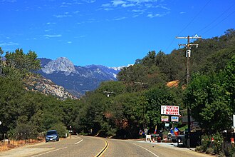
Things to Do in Bakersfield
1
Buck Owens' Crystal Palace
Experience the history of country music in this famous venue and museum.
2
Kern County Museum
Explore the history of the region through extensive exhibits and historic buildings.
3
Hart Memorial Park
Enjoy outdoor activities like picnicking, fishing, and hiking in this large park.
4
Bakersfield Museum of Art
Discover local and regional art in this community-focused museum.
Tags
Richland to Bakersfield
flights to Bakersfield
driving WA to CA
Tri-Cities to Bakersfield
Bakersfield travel guide
cross country road trip
best travel routes
US travel